11 Famous Rivers of Uttarakhand to Discover the Beauty
A brief list of Major Rivers across Uttarakhand
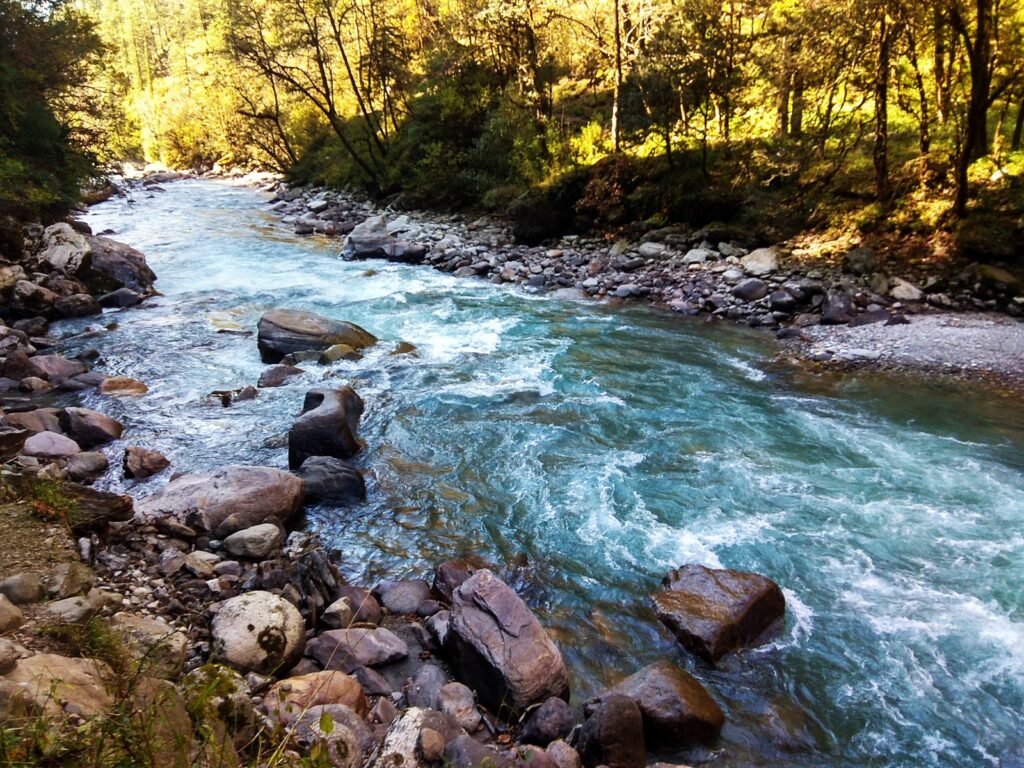
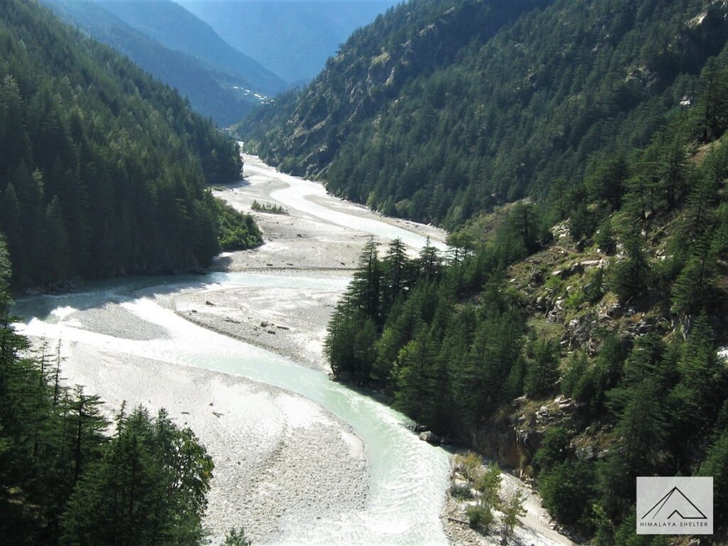
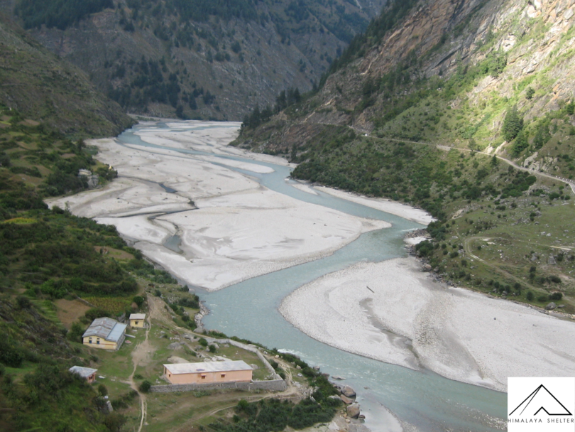
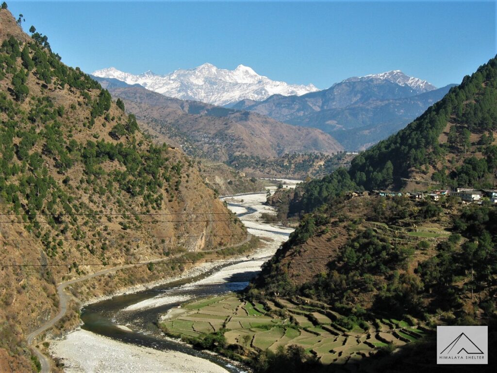
The land of gods, also commonly known as the Devbhoomi, Uttarakhand is an Indian state that is blessed with the ever-flowing iridescent rivers, making the landscape undoubtedly one of the most pristine in North India. Holy and sacred in nature, the rivers of Uttarakhand are largely considered auspicious and lively. It is believed that the rivers, originating from the glaciers of India, Tibet, and Nepal are not only religiously significant but also play an important role in the cultural, economic, and environmental lives of the state and its citizens.
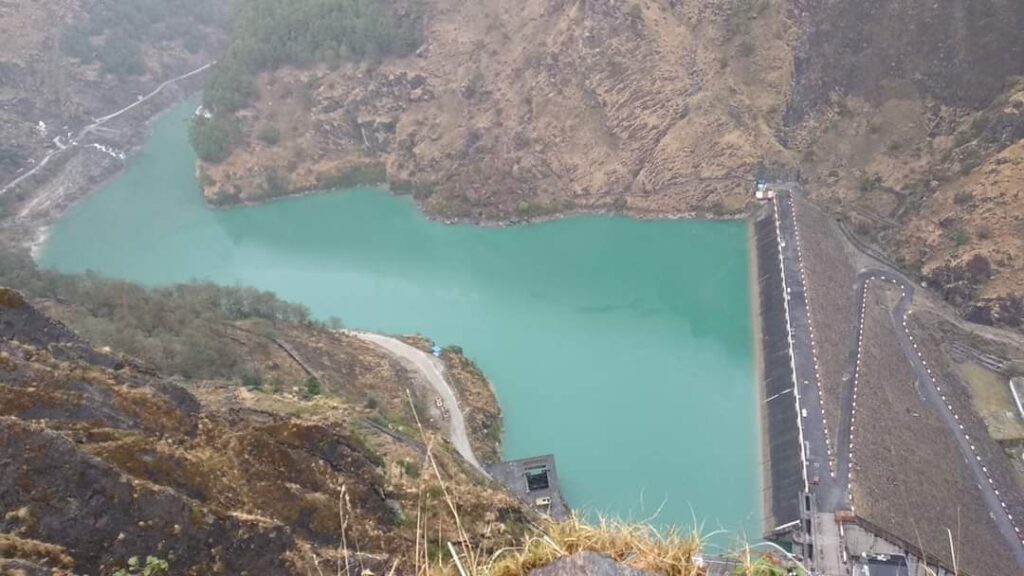
Uttarakhand minus the rivers would literally be nonexistent! Considered the backbone of the state, the rivers are used for a variety of purposes, ranging from prayers to agriculture and even carrying out day-to-day chores. Catering to the ritual needs of the Hindu devotees, the rivers of Uttarakhand are also famous for forming Sangams, i.e., the convergence of two rivers at a given point. These sangams are termed as prayags and there are five main Prayags that render Uttarakhand’s importance as a religious and spiritual state! Highly relevant in Hindu mythology, these rivers are still worshipped today. Each river has its own notable presence, making it paramount importance. The rivers are also a source of major hydro and irrigation projects, having disastrous consequences on the ecosystem in particular and the environment in general.
Famous Rivers of Uttarakhand:
Here are a few major rivers flowing among the Indian Himalayas of Uttarakhand, starting from Tons in the west till Kali in the east!
1. Alaknanda:
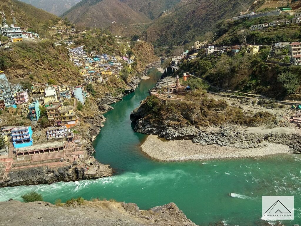
Originating from the Satopanth Glacier and the Bhagirathi Kharak Glacier, Alaknanda (a Himalayan river) is considered the source stream of the Ganga, alongside Bhagirathi. The length of Alaknanda is 190 km, flowing through major towns of the Garwhal division; covering Chamoli, Rudraprayag, and Pauri Garhwal districts. It meets Dhauliganga at Vishnuprayag, Nandakini at Nandprayag, Pindar at Karnaprayag, Mandakini in Rudraprayag, and Bhagirathi in Devprayag; where it officially becomes Ganga.
Alaknanda is considered to be one of the holiest rivers of the state as it cuts through the very famous town of Badrinath, the last destination of Char Dham yatra. Alaknanda River is also desired for its adventurous side as its white waters and ferocious rapids offer the thrill of a lifetime. Currently, there are 6 operational hydel projects on Alaknanda and 8 are under construction.
2. Bhagirathi:
Bhagirathi River originates from Gaumukh, the base of the Gangotri and Khatling glaciers in Uttarakhand. Crossing Gangotri, a part of the Char Dham Yatra, Bhagirathi is considered holy, as it is believed that its origins are highly regarded in Hindu legends.
Bhagirathi (meaning, ‘caused by Bhagiratha’) has been named after King Bhagiratha, who meditated to bring Ganga on earth so that the sins of his forefathers could be washed away. It is joined by tributaries such as Kedar Ganga, Jadh Ganga, Kakora Gad, Jalandari Gad, Siyan Gad, Asi Ganganear, and Bhilangana. It flows past Kedarnath, where people make sure to take a dip so as to wash away their sins. The length of the river is 205 kilometers, starting at an elevation of 3,892 meters. The confluence of Bhagirathi and Bhilangana is also the region where the very famous, yet controversial, Tehri dam was built (the highest dam in India, completed in 2006).
3. Dhauliganga (Garwhal and Kumaon):
Dhauliganga is one of the six source streams of Ganga, flowing for 94 km, before meeting Alaknanda at Vishnuprayag. Dhauliganga of the Garwhal district emerges from Deovan Himani. It rises to an elevation of 5,070 meters at Niti Pass in the Chamoli district. Tapovan, which is famous for hot springs, is also situated on the banks of Dhauliganga. There are three hydro projects that are to be set up on the Dhauliganga, all of them located in the Chamoli district: Lata Tapovan, Maleri Jhelum, and Jhelum Tamak.
There is another Dhauliganga that transverses through the Kumaon division of Uttarakhand. Dhauliganga in this division is a tributary of the Kali River. It flows for 91 km before merging with Kali at Tawaghat. It emerges from Govan Khana Himani.
4. Ganga:
Also known as the Ganges, the Ganga is considered one of the holiest rivers in India and the entire world. It emerges from the confluence of Alaknanda and Bhagirathi and exits Uttarakhand on the plains of Haridwar. The 2,510-kilometer river drains into the Sunderban delta in the Bay of Bengal.
The Ganga is also a river full of stories. As an important river in mythology, the capitals of many empires since ancient India have been built along its banks. Ganga has also been a symbol of divinity, spirituality, purity, and salvation. In Hindu mythology, it is worshipped as a goddess (the one who absorbs all the sins), thereby luring millions of pilgrims to its banks every year. Ganga is also known as Vishnupadi, as the legends hold that Ganga emerged from the feet of Lord Vishnu. Besides bathing to wash away sins, it is also used for cremation purposes. The very famous Kumbh Mela is also held along its banks.
Ganga originates from various glaciers: Satopanth, Khatling, and the peaks of Kedarnath, Kamet, Nanda Devi, Nanda Kot and Trishul. Ganga also comprises many streams, the top six being Alaknanda, Bhagirathi, Mandakini, Dhauliganga, Pindar, and Nandakini. There are various hydel projects situated on the river; including canals, dams, and barrages. The length of the Ganga in Uttarakhand is 96 km.
5. Gori and Kali Ganga:
Gori Ganga, also known as Ghori Ganga, originates from the Milam glacier; and flows for 104 km before merging with Kali Ganga in Jauljibi. It flows from the eastern wall of the Nanda Devi National Park and runs through the district of Pithoragarh. Kali Ganga flows from Lipmpiya Dhura at an elevation of 3,600 meters and ends in Uttar Pradesh after merging into the Ghagra River. It is also joined by the Dhauliganga River at Tawaghat. Kali Ganga becomes the Sharda River when it enters the plains at Tanakpur. It attracts rafters from all over India as it is blessed with level 4 whitewater rapids!
6. Mandakini and Nandakini:
Emerging from the Chorabari glacier near Kedarnath, Mandakini drains into Alaknanda in Rudraprayag. Before this, it merged with the Kali Ganga near Kalimath temple and the Madhyamaheswar Ganga near Ukhimath. It mainly flows through the Garhwal district of the state. The river is pious and holy, as is mentioned in Bhagwat Geeta, a Hindu scripture. The name usually signifies ‘the river of the air or heaven’.
Passing by Kedarnath, it is worshipped by millions of pilgrims, thereby offering spiritual deeds to all! It only flows for 72 km but is very ferocious and turns extremely violent during the monsoons, engulfing the villages and roads in its proximity. Mandakini is the river responsible for the Kedarnath floods of 2013, which led to the huge destruction of life, property, and the environment. It is also preferred by rafters as they get to enjoy the adventurous side of the river with Grade IV and V white water rapids.
Nandakini originates from Nanda Ghughati, within the Nanda Devi Wildlife Sanctuary. The river flows for 56 km before merging with Alaknanda at Nandaprayag. Mostly calm, Nandakini flows through the Garwhal district.
7. Pindar:
Emerging from the Pindari glacier in the Bagheshwar district of Uttarakhand, the Pindar River is also known as the Pindari River. It flows for 105 km, crossing small towns like Manmatti, Dewalo, Bhagori, and Nauti. It finally merges with Alaknanda at Karnaprayag.
8. Ramganga (Western and Eastern):
The western Ramganga river originates from the Dhudhatoli ranges in the Pauri Garhwal district of Uttarakhand. It flows for 155 kilometers and cuts between Jim Corbett National Park and the plains. In Uttarakhand, it passes through Taal, Bhagoti, and Masi in the Kumaon division. It feeds to the cities of Moradabad, Bareilly, and Shahjahanpur in Uttar Pradesh and joins the Ganga near Kanauj in the Fatehgarh district. Ramganga is also known for its dam, Ramganga Dam (also known as Kalagarh Dam), built in the district it originates from.
The source of the eastern Ramganga is the Namik glacier, which is situated southeast of the Nandakot peak. It flows for 108 km in the Kumaon region before merging with the Saryu River at Rameshwar. Rendering land near its bank very fertile, eastern Ramganga flows through the towns of DIdihat, Gangolghati, and Narayan Ashram.
9. Saryu:
A Himalayan river flowing through the Kumaon region, Saryu (also known as Sarju), originates from Sarmool. It flows for 146 km before merging with the Mahakali river at Pancheshwar. At Bageshwar, it meets the Gomti River. The confluence of these two rivers is famous for being dotted with Bagnath temple. Sodhra, Gwara, Song, Kapkot, and Rameshwar are a few towns located on the bank of Saryu. Bhuni, Sup, and Khati are the famous ghats of this river.
10. Tons:

One of the prime Himalayan rivers, the Tons, emerges from the meltwaters of the Banderpoonch mountain. It is the largest tributary of Yamuna, flowing for 148 km before merging with the same near Dehradun, at Dak Pathar. It has a heavier flow than the Yamuna itself. The source of the Tons River comes mainly from the convergence of the Rupin and Supin rivers in Himachal Pradesh and Har Ki Dun Valley, respectively, at a small hamlet known as Naitwar.
Tons flow through the villages of Sankri, Mori, Mahasu, and Hanol. Its two main tributaries are the Pabbar and Asan rivers. The mythical origin of the Tons River is related, through a legend, to Mori. Mori is located on the banks of Tons River in the Uttarkashi district of Uttarakhand. The people of Mori are followers of Kauravas. It is believed that when Pandavas defeated the Kauravas, the people of the valley cried and cried, and hence Tons River is a creation of their unstoppable tears. Tons is also highly regarded for its flow making it an ideal destination for rafters!
11. Yamuna:
Just as important as Ganga in the Hindu mythology, the Yamuna is a highly renowned river in Northern India. Originating from the Yamunotri glacier at an elevation of 6,387 meters, Yamuna flows through the Lower Himalayas and Shivalik ranges before entering the plains. Yamunotri is also a part of the Char Dham yatra. It exits Uttarakhand at Dhalipur after flowing through the Garhwal region.
Tons is the largest tributary of Yamuna, flowing from the feet of Har Ki Dun valley. Yamuna is the longest tributary of India and the second longest of Ganga before meeting the same at the Triveni Sangam. Triveni Sangam is the confluence of Ganga, Yamuna and the Invisible Saraswati river at Allahabad. The confluence is also the site of the Khumb Mela, which takes place every 12 years.
YamThe Yamunas many legends attached to it making it a significant river in the lives of millions of Indians. In Hindu mythology, Yamuna is the daughter of the Sun God, Surya, and sister of Yama, the God of Death, hence also known as Yami and according to popular legends, bathing in the sacred waters frees one from the torments of death. Flowing for 1,376 km, Yamuna is not only important for religious purposes but also for others. It is used for irrigation activities all over north India. However, in recent times, the condition of Yamuna has worsened. With huge amounts of pollutants being released into it daily, Yamuna has become one of the most polluted rivers in the world. To tackle this, the government has launched various projects to save Yamuna. However, due to a lack of effective implementation, the condition remains the same.
Trekking companies in Dehradun | Har Ki Dun trek | Bali Pass trek | Phulara Ridge Trek | Kedarkantha Trek| Dayara Bugyal trek | Gaumukh Tapovan trek | Kashmir Great Lakes trek | Valley of Flowers trek | Nag Tibba Trek | Kuari Pass trek | Chopta Chandrashila Trek | Kedarkantha Trek in January | Winter Dayara Bugyal
FAQs:
How many rivers are there in Uttarakhand?
Which is the longest river of Uttarakhand?
Which three rivers meet at Uttarakhand?
What is the Nandakini river origin?
Which states are crossed by the Gomti River?
Related Blogs

September 28, 2023
8 Essential Safety Tips for Trekking in the Himalayan Mountains for a Safe Journey
Trekking in the Himalayas offers a unique experience, combining imposing peaks, serene valleys, and diverse cultures. Preparation and safety are crucial.
Read more
September 25, 2023
14 Best Destinations for Spiritual Trekking in the Indian Himalayas
Explore the divine heights of the Indian Himalayas with our guide to the 14 Best Destinations for Spiritual Trekking.
Read more
September 22, 2023
Solo or Group Trekking in the Himalayas: Which is Best for You
Explore the pros and cons of solo and group trekking in the majestic Himalayas to find out which suits your trekking style best.
Read more
September 22, 2023
13 Best Himalayan Treks To Do in October, November, and December in India
Discover stunning treks to do in Himalaya in October, November, and December in India.
Read more
September 18, 2023
Himalayan Trekking Permits: A Complete Guide for Adventurers
Explore our comprehensive guide to Himalayan Trekking Permits, designed for adventurers like you.
Read more
September 18, 2023
Discover the Top 15 Trekking Places in Kashmir in 2023 From Lakes to Peaks
Discover the top trekking places in Kashmir featuring stunning lakes and towering peaks.
Read more
August 23, 2023
Discover the Must-Have Hiking Essentials for Beginners in the Himalayas
Prepare well for beginner Himalayan treks: essentials, best routes, high altitudes, fees, and cultural immersion for a secure adventure.
Read more
August 18, 2023
Understanding Acute Mountain Sickness: Causes, Symptoms, and Treatments
Discover the causes, symptoms, prevention strategies, and effective treatments for Acute Mountain Sickness (AMS).
Read more
August 16, 2023
10 Stunning Treks Near Manali, Himachal Pradesh in 2023
Explore Himachal's stunning landscapes with thrilling Manali treks. Experience extraordinary walks amidst magnificent mountains and serene roads.
Read more
August 14, 2023
9 Best Short Treks in Uttarakhand for 1, 2, or 3 Days for a Weekend Escape
Explore Uttarakhand's stunning weekend getaways with short treks, immersing yourself in nature's beauty and adventure on these breathtaking trails.
Read more
August 9, 2023
10 Toughest and Most Difficult Treks in India in 2023 to Push Your Boundaries
Discover the toughest and most difficult treks in India and test your endurance in the breathtaking landscapes of the Himalayas.
Read more
July 25, 2023
11 Best Places to Visit in Sonamarg, Things to Do & Attractions
Sonamarg, in India, captivates with its stunning landscapes. Nestled in Kashmir, it's a serene haven for nature and adventure enthusiasts.
Read more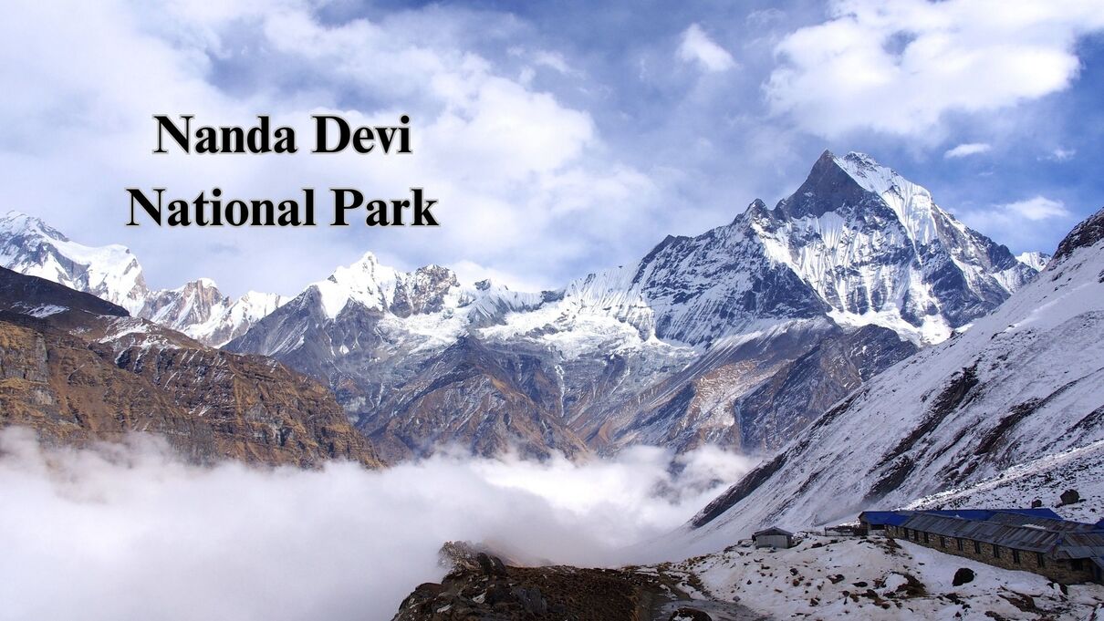
July 24, 2023
Nanda Devi National Park, Uttarakhand - How To Reach, Best Time to Visit
Nanda Devi National Park, in Uttarakhand, India, is a UNESCO World Heritage Site known for its stunning Himalayan landscapes.
Read more
July 19, 2023
15 Best Himalayan Treks for Beginners in India in 2023
Discover beginner-friendly treks in India's Himalayas. Experience breathtaking mountain beauty, push limits, and connect with nature in stunning landscapes.
Read more
July 18, 2023
Top 15 Highest Mountain Peaks of Uttarakhand in 2023
The state of Uttarakhand boasts of two of the top three mountains in India. Read the blog to find out about the famous peaks of Uttarakhand...
Read more
September 10, 2021
Why Is Hydration Important during Himalayan Treks?
Garhwal Himalaya offers thrilling treks. Hydration is crucial, and it's essential to drink water regularly, even in colder temperatures.
Read more
February 1, 2024
Why Bali Pass Should Be Your Next Trek?
Why Bali Pass Trek should be your very next trek? The complete guide. This artiucle has answer of almost all your questions.
Read more
September 4, 2021
Valley of Flowers and Hemkund Sahib
A day wise visual blog from Valley of Flowers & Hemkund Sahib trek...
Read more
September 8, 2021
Uttarakhand - Your all year adventure destination
The “Land of Gods” is blessed with five distinct seasons. Read the blog to find out about Uttarakhand's all year adventures...
Read more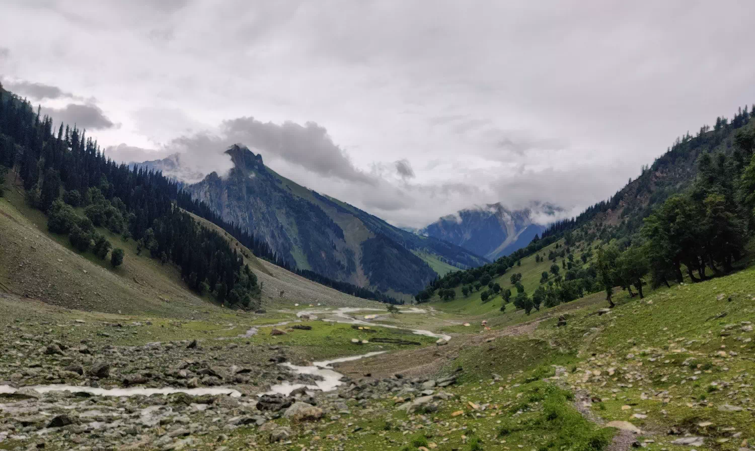
March 2, 2023
Unforgettable: Kashmir Great Lakes Trek in the Himalayas Explained
Embark on the Kashmir Great Lakes Trek, a unique journey exploring seven breathtaking alpine lakes amid Himalayan grandeur.
Read more