Glaciers of Uttarakhand :
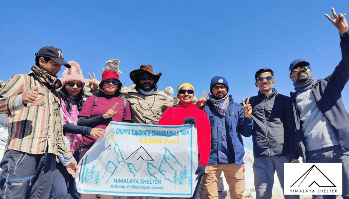
The visuals of the brave Indian soldiers standing guard in full extreme-weather combat gear on what is deemed as the world’s highest battlefield, the Siachen Glacier, have always left us all feeling enormously proud and inspired. To all the adventure seekers who wish to experience such landscapes, I would like to introduce you to the most significant glaciers of Uttarakhand which are accessible on a moderate-difficult multiday trek.
The Glaciers of uttarakhand are notable for being the source ‘ugam’ of some of the holiest rivers in India. For this reason, many have always been major pilgrimage sites. These massive frozen reservoirs are showing signs of climate change. The glaciers are retreating at an alarming rate and hope is that by being in their presence we would be encouraged to adopt some sustainable life changes to combat the effects of human footprint.
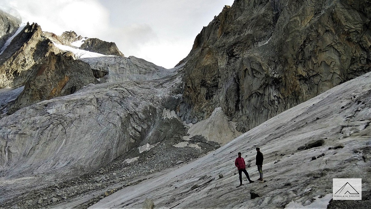
Picture Credit - Vaibhav Pisal

Let me begin with the holiest and the mightiest of all, the Gangotri Glacier which is a famous glaciers in Uttarakhand. Nestled in the Gangotri range of mountains in Uttarkashi district, is a humongous glacier spanning 30 km long and 2 to 4 km wide. It originates at a cirque below Mt. Chaukhamba, the highest mountain in the range. It flows north west towards the holy town of Gangotri. The snout of the glacier once resembled a cow’s mouth and hence is known as Gaumukh. The glacier acts as the source of river Bhagirathi, which is one of the two source streams of river Ganga.
The moderate Gaumukh-Tapovan trek, in the Gangotri National Park, leads you adjacent to the glacier and one can opt to travel further to the Tapovan meadow, at the base of Mt.Shivling, to really let the grandeur of the place sink in.
The Gangotri glacier has three main tributary glaciers, namely Raktavarna (15.90 km), Chaturangi (including Kalandini Bamak) (22.45 km) and Kirti (11.05 km) and more than 18 smaller tributary glaciers.
If you wish to pursue further, trudge along to Nandanvan from Tapovan for a challenging high pass crossing of Kalindi Khal trek at almost 6000 m. This arduous trek gives you an opportunity to see a rare red Raktavarna glacier and traverse the Chaturangi Glacier with camping at Sweta glacier.
The river Alaknanda, the main source stream of river Ganga, originates from the confluence of Satopanth Glacier (13 km long) and Bhagirath Kharak Glacier (18 km long) in the Chamoli district of Uttarakhand. The eastern slopes of Mt. Chaukhamba feed these glaciers.
During the summer months, the Satopanth Glacier is accessible to ardent trekkers. Approachable from the holy town of Badrinath and “last” Indian village of Mana, the trek route runs along the river Alaknanda to Satopanth Tal, a glacial lake.

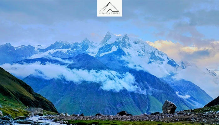
Picture credit - deepak kalappa
Khatling Glacier, the source of the Bhilanganga River is located in Tehri Garhwal region, which is a major tributary of river Bhagirathi. At an elevation of 3,717 m it is approximately 50 km from Gaumukh. Mayali Pass trek, a crossover from Bhagirathi valley to Mandakini valley offers spectacular glacier view along with enchanting glacial lakes of Sahastra tal and Masar tal and ending the journey at Vasuki tal near the holy town of Kedarnath. One is also rewarded with the glacier views after a hard and long climb to Auden’s Col, a challenging mountain pass at 5490 m.
Kedar Bamak glacier, source of Kedar Ganga can be seen kissing the feet of Mt. Thalaysagar and Mt. Bhrigupanth nestled in the Gangotri National Park. One gets to witness the glorious views of this glacier on a difficult but rewarding trek to the emerald blue glacial lake of Kedar Tal.
Chorabari Bamak glacier standing at 4000 m near the holy town of Kedarnath, is the primary source of river Mandakini, which is a tributary of Alaknanda river. On the morning of June 17 in 2013, glacial Chorabari lake breached its banks, bringing a massive flash flood down the slope to the temple town causing massive destruction in its path. The lake is no more in existence and what is left behind is moraine and debris.
Dokriani Bamak glacier settled between Mt. Draupadi ka Danda and Jaonli Peak is 5 km long and stretches in the northwest direction. The glacial waters form a stream called Dingad which flows on to merge with Bhagirathi river. Accessible from Uttarkashi in summer and autumn, a 23 km long trek through some beautiful meadows rewards you with grand views of the glacier and a lake in tow.
Panpatia Glacier at an altitude of 5259 m as the legend has it, was the route the sages traversed between the holy towns of Badrinath and Kedarnath. The Col, which is surrounded by major peaks of Garhwal like Nilkantha, Balakun, Kunaling, Janhukut, Shri Parbat and the mighty Chaukhamba massif is one of the most endurance and will power testing trek in India. It has it all, high mountain passes, moraines, gushing streams, alpine meadows and lakes.
It has been observed over the years how the Tipra Bamak glacier, over 5 km long, in the Alaknanda river basin has shrunk resulting in a large part of the glacier detaching from the main trunk and forming Tipra (3865 m) and Rataban (4120 m), two separate glaciers. If one wishes to retrace Frank Smythe’s steps and go beyond the revered Valley of Flowers, the Bhyundar Khal trek offers an opportunity to navigate Gauri, Rataban and Tipra Glacier. The trek presents stunning views of Mt. Nilkanth and Hathi Parvat.

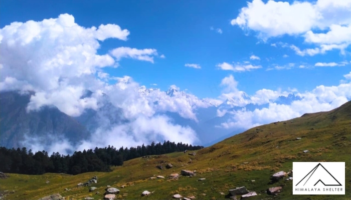
Picture credit - Karthik Tripurari
Pindari Glacier, around 3 km long at an elevation of 4625 m is situated in the Kumaon region of Uttarakhand southeast of Mt. Nanda Devi and Mt. Nanda Kot. Pindar river originating from the glacier, flows on to join Alaknanda river. A 100 km round trip is a fascinating and a popular moderate trek to the Zero Point of the glacier.
Kafni Glacier, located at the foot of Mt. Nanda Kot, is 3 km long and gives birth to river Kafni, which flows on to meet Alaknanda river. Avid trekkers can enjoy the splendid flora and fauna on the way to the Zero Point which is a 90 km round trip. Unlike Pindari glacier one can trek beyond Zero point without any technical challenge on the way.
Namik Glacier located in the near vicinity of Kafni glacier, rises at the altitude of 3600 m and is 3 km long. The glacier is the source of the river Ramganga and falls on the ancient trade route between India and Tibet. On the 81 km round trek to the glacier one is rewarded with magnificent views of the Panchachuli range of mountains along with the imposing Mt. Nanda Devi, Mt. Nanda Kot and Mt. Trisul.
Milam Glacier, a 16 km long glacier at the altitude of 4242 m, is one of the major glaciers in the Kumaon region of Uttarakhand. Originating from the eastern slopes of Mt. Tirsuli, it is also fed by subsidiary glaciers off the surrounding peaks of Mt.Hardeol, Mt. Rishi Pahar, Mt. Nanda Gond and Mt. Nanda Pal. The glacier is the source of river Goriganga. Once closed for trekkers for security reasons since Sino-India war in 1962, it was reopened in 1994 and is now one of the most revered treks accessible from the months of March to May and post monsoon to October.
Kalabaland Glacier is a 15 km long glacier located north of Milam glacier in the eastern Kumaon region of Uttarakhand. Several peaks like Burphu Dhura, Bamba Dhura, Chiring hug the glacier in a horse shoe shaped valley. The glacier joins hands with two massive glaciers of Yangchar and Sankalp feeding the river Ralam Gad. April to June and September to November are the best months to head to these glaciers from Munsiyari.
The twin glaciers of Sona and Meola along with Uttari Balati and Dakshini Balati together form the Panchachuli Glacier on the eastern front of Panchachuli massif. One can approach the glacier with a 40 km long trek through meadows and snow caped surroundings in Darma valley in Pithoragarh district.
Finally, on the western edge of high Himalayas in the state, Bandarpunch Glacier at 4,442 m is located in the Garhwal region of Uttarakhand. This 12 km long glacier feeds Ruinsara Gad on the north side and Hanumanganga on the south side of Mt. Bandarpunch and is the prime source of the river Yamuna. A trek to the high-altitude lake of Ruinsara tal and its surroundings is the perfect way to approach the glacier.
A few other glaciers
Arwa glacier, along with its tributaries, is spread for about 12 km and lies North-East of Kalindi Khal.
Situated inside Nanda Devi National Park, Bagini glacier lies at an altitude of around 4,500 m. Located near the base of peaks like Changabang and Tirsuli, the trek to Bagini glacier was among the explorations of Shipton and Tilman. A beautiful and exciting route, the trek is gaining in popularity.

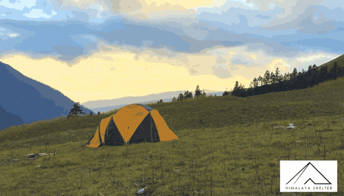
Picture credit - Arnab Das
Jaundhar glacier starts from the North-eastern flank of Swargarohini peak and melts into the Supin river. The upper reaches of the glacier can be seen near the horizon from the famous Har ki Dun trek. Most of the lower part of Jaundhar glacier is covered in boulder and scree and it ends at around 8-10 km away from the meadows at Har ki Dun. Though Har ki Dun is one of the most popular treks in Uttarakhand, this glacier has rarely been explored.
Uttarakhand Treks | treks in Uttarakhand | Treks from Dehradun | trekking in Dehradun | Trekking companies in Dehradun | Har Ki Dun trek | Bali Pass trek | Phulara Ridge Trek | Kedarkantha Trek| Dayara Bugyal trek | Gaumukh Tapovan trek | Kashmir Great Lakes trek | Valley of Flowers trek | Nag Tibba Trek
About Author

Ashwini Paralkar
"Traveling is my way to positive mental health and a fitter existence. I feel more at home photographing the outdoors and making a lasting connection with the land and its people. I hope to inspire everyone through my writing to go out and explore."
Recent news
10 Oct 2025
08 Oct 2025
07 Oct 2025
23 Sep 2025
22 Sep 2025