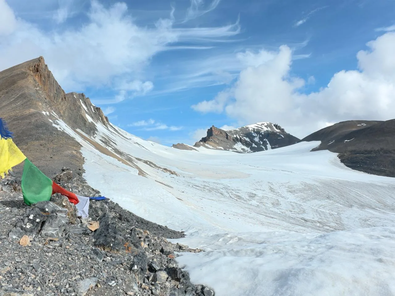
Kongmaru La
Altitude: Approximately 5,260 m / 17,260 ft
Trek: Markha Valley Trek
Region: Hemis National Park
Kongmaru La is one of the most famous trekking passes in Ladakh and an important highlight of the Markha Valley Trek.
The pass connects the Markha Valley with the Nimaling Valley and offers spectacular views of the surrounding mountains. On a clear day, trekkers can see several prominent peaks of the Ladakh and Karakoram ranges.
The climb to Kongmaru La is demanding because of the altitude, but the landscape makes the effort worthwhile. The trail passes through barren mountains, rocky slopes, high-altitude meadows and remote villages.
For trekkers looking for their first major high-altitude pass in Ladakh, the Markha Valley route is one of the most popular options.
Ganda La
Altitude: Approximately 4,970 m / 16,300 ft
Trek: Markha Valley Trek
Region: Near Leh
Ganda La is another important pass on the traditional Markha Valley trekking route.
The trail takes trekkers through the rugged landscape around Leh and gradually enters the remote Markha Valley. From the pass, there are impressive views of the surrounding mountains and valleys.
One of the interesting aspects of the Ganda La crossing is the changing scenery. The route moves from the relatively developed areas around Leh into a much more remote Himalayan landscape.
Ganda La can also be combined with other high passes on longer Markha Valley itineraries.
Stok La
Altitude: Approximately 4,900 m / 16,000 ft
Trek: Stok Kangri region and Stok routes
Region: Stok Range
Stok La is located in the Stok Range south of Leh. It is associated with trekking routes that explore the high mountains surrounding the Stok region.
The landscape around Stok La is distinctly Ladakhi, with rocky ridges, barren slopes and wide mountain views. The pass is also part of routes that venture deeper into the Stok Range.
Trekkers should not underestimate the altitude. Even when the distance appears manageable, climbing above 4,500 metres can be physically demanding.
Parang La
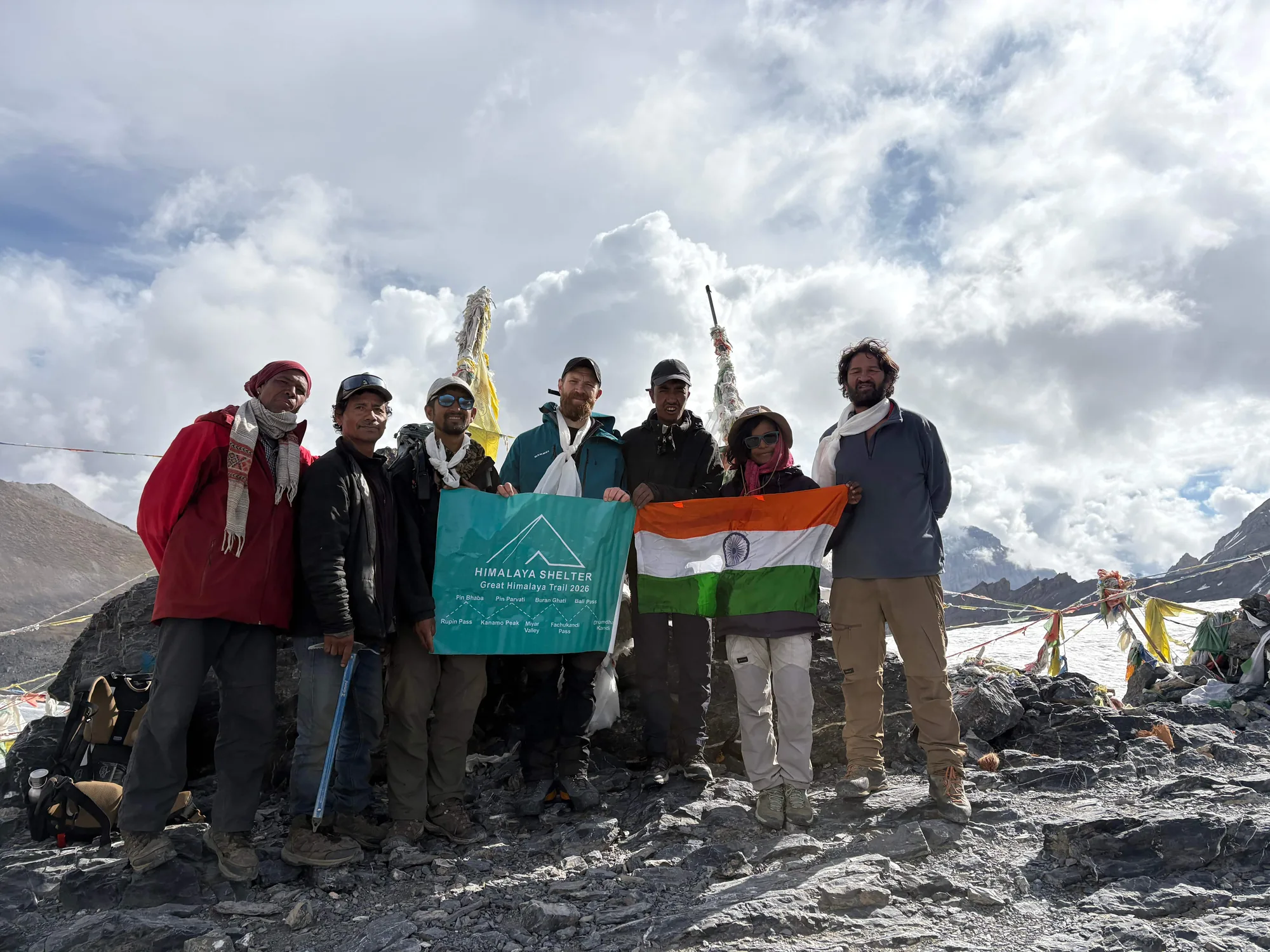
Altitude: Approximately 5,580 m / 18,300 ft
Trek: Parang La Trek
Region: Ladakh–Spiti
Parang La is one of the most spectacular and challenging trekking passes in the region.
The Parang La Trek connects Ladakh with Spiti Valley in Himachal Pradesh. The route travels through some of the most remote landscapes of the western Himalayas, including high-altitude valleys, rivers, glaciers and barren mountain terrain.
The pass itself is covered with snow and ice depending on the season and conditions. Crossing Parang La requires strong physical fitness, proper acclimatization and experience with high-altitude trekking.
One of the major attractions of this trek is the dramatic contrast between the landscapes of Ladakh and Spiti. It is a route for experienced trekkers looking for a serious Himalayan adventure.
Zalung Karpo La
Altitude: Approximately 5,197 m / 17,050 ft
Trek: Remote Ladakh trekking routes
Region: Eastern Ladakh
Zalung Karpo La is one of the lesser-known high mountain passes of Ladakh. Far from the busy tourist routes, it offers the kind of remote Himalayan landscape that experienced trekkers look for.
The trail around the pass leads through rugged mountains, wide valleys and high-altitude terrain, with very few signs of modern development. The sense of isolation is one of its biggest attractions.
A trek involving Zalung Karpo La requires careful planning, good acclimatization and strong logistical support. Weather and trail conditions can change quickly at these elevations, so it is best suited to experienced trekkers and expedition-style groups.
Matho La
Altitude: Approximately 5,010 m / 16,437 ft
Region: Matho Valley, Ladakh
Matho La is a high mountain pass associated with the Matho Valley and the mountains southeast of Leh. The route takes trekkers away from the more frequently visited areas and into a rugged landscape of barren ridges, rocky slopes and high-altitude valleys.
The Matho region is also known for its cultural connection with Matho Monastery, making a trek here an interesting combination of mountain scenery and Ladakhi culture.
For trekkers interested in exploring quieter routes around Leh, Matho La Trek provides an opportunity to experience a less-travelled side of Ladakh.
Poat La
Altitude: Approximately 5,500 m / 18,000 ft
Region: Remote Ladakh
Poat La is another remote high-altitude pass that showcases the rugged character of the Ladakh Himalayas. Unlike famous road passes such as Khardung La and Chang La, Poat La is associated more with remote trekking and expedition-style routes.
The landscape around the pass is dominated by barren mountains, rocky terrain and vast open valleys. At this elevation, the environment is harsh, and trekkers need to be prepared for cold temperatures, thin air and rapidly changing weather.
Poat La Trek is best considered by experienced high-altitude trekkers who are comfortable with remote Himalayan terrain and longer expedition-style itineraries.
Kang La
Altitude: Approximately 5,500 m+
Trek: Kang La routes
Region: Ladakh
Kang La is a high mountain crossing associated with remote trekking routes in Ladakh.
The pass lies in a rugged landscape far from the usual tourist circuits. Trekkers encounter rocky mountains, glacial terrain and remote valleys where human settlements are limited.
Routes involving Kang La are generally more demanding than popular trekking routes around Leh. They require careful planning, suitable equipment and strong support arrangements.
Digar La
Altitude: Approximately 5,400 m / 17,700 ft
Trek: Nubra Valley high-altitude trekking routes
Region: Ladakh
Digar La is located in the high mountains between the Leh region and Nubra Valley.
The pass is known for its expansive views across the surrounding mountain ranges. The landscape becomes increasingly remote as the trail climbs higher, with rocky slopes and high-altitude terrain dominating the route.
For trekkers exploring less-travelled routes in Ladakh, Digar La offers a very different experience from the more popular Markha Valley trails.
Lasermo La
Altitude: Approximately 5,400 m / 17,700 ft
Trek: Lasermo La Trek
Region: Ladakh–Nubra
Lasermo La is one of the high passes connecting the Leh side of Ladakh with Nubra Valley.
The Lasermo La Trek is known for its remote character and challenging terrain. The route crosses high mountain landscapes before descending towards the Nubra region.
The pass can be particularly demanding because of its altitude and changing weather conditions. Trekkers should be prepared for steep climbs, cold temperatures and difficult trail conditions.
Khardung La
Altitude: Approximately 5,359 m / 17,582 ft
Region: Leh–Nubra Valley
Khardung La is perhaps the most famous mountain pass associated with Ladakh.
Unlike most of the passes on this list, Khardung La is primarily a road pass rather than a trekking pass. It forms part of the road connection between Leh and Nubra Valley and is frequently visited during Ladakh road trips.
The surrounding landscape is spectacular, with barren mountain slopes and views across the high Himalayas.
For trekkers, Khardung La is important mainly because of its location and its connection to the Nubra region.
Chang La
Altitude: Approximately 5,360 m / 17,590 ft
Region: Leh–Pangong route
Chang La is another famous road pass in Ladakh. It lies on the route between Leh and Pangong Lake.
Although it is not primarily a trekking pass, it is one of the most recognizable high-altitude crossings in Ladakh. Travellers experience a dramatic change in landscape as the road climbs through the mountains before descending towards the Pangong region.
Trekkers visiting Ladakh often cross Chang La as part of their road journey to and from Pangong Lake.
Tanglang La
Altitude: Approximately 5,328 m / 17,480 ft
Region: Leh–Manali route
Tanglang La is one of the major high passes on the Manali–Leh highway.
It is primarily a road pass rather than a trekking destination, but it demonstrates the extreme elevations found across the Ladakh region.
The surrounding landscape is dominated by barren mountains and vast high-altitude terrain, giving travellers a sense of the scale and remoteness of the Trans-Himalayan region.